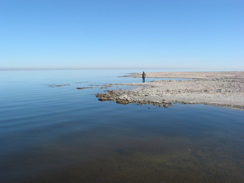

A couple of times while staying at the Borrego Palm Canyon Campground in Anza Borrego State Park, we took day trips to the Salton Sea. The Salton Sea is a huge body of water about 32 miles east of the city of Borrego Springs. It is reported to be the largest lake in California with an average size of 15 miles by 35 miles. The picture above looks nice doesn’t it? Well … my daughter is standing on dead fish. The beach all around this huge lake is covered almost entirely with dead fish.
A Beautiful Day At The Beach?


This is the beach. Fish, not sand. The water has become so polluted and salty that it’s killing all of the fish. I believe the only species left is Tilapia. They are very tolerant of salty water, but it’s becoming too much for them and in combination with the agricultural run-off pollution pouring into the lake, they are dying in the millions. Literally. On a hot day, the smell is … you know.
And now for some fractured history …
The lake being here at all is the result of an accident. The area has almost always been a dry lake bed with water coming and going in irregular cycles. Around 1900, the California Development Company dug irrigation canals from the Colorado River into the valley, where the Salton Sea is today, for agriculture. In 1905, an additional cut was made in the bank of the Colorado River to increase irrigation canal water flow because of silt buildup. Water flow increased so much that the irrigation canals were overwhelmed. The Colorado river flowed into the Salton Basin unchecked for about two years, creating the Salton Sea, before it could be stopped. Today, because of changes in water management agreements for the Colorado River, no more water is flowing into the Salton Sea from the Colorado River, so the water level is declining. The Salton Sea does have some water inflow from a few small rivers and from agricultural runoff, but not enough to keep it filled. Locals say there is talk of plans to restore the area, but I think it’s just that, talk. I don’t believe anything serious is being considered to replenish the Salton Sea.


It’s actually an eerily beautiful place if you like the bizarre. I won’t say which of our family did or did not like it there so you won’t think some of us are weird.
Mud Volcanoes!!
Did you know there are mud volcanoes at the Salton Sea? We didn’t. The southern end of the Salton Sea, near the city of Niland, is a hotbed (pardon the pun) of geothermal activity. Geothermal power plants are all over the place. To see the mud volcanoes, we visited the Davis-Shrimpf seep field on the southeastern shore of the Salton Sea. Supposedly, magma is only a little more than a mile below. The magma plume is thought to be about 20 miles long, 4 miles wide, and one to two miles thick. The heat from the magma powers geothermal plants, warms up water for numerous hot springs, creates mud volcanoes and bubbling mud pots. Here’s the proof…


It was windy as you can hear …
We had mud splattered all over us by the time we left. You can hear these things bubbling and spurting. When one gets quiet, it’s because mud has filled the neck of the volcano. When the pressure builds up enough inside (usually in a few seconds), mud is blown out. If you are near by, you get dirty. Then warm mud flows down the sides just like magma from lava volcanoes. If you are in the area, the Salton Sea mud volcanoes are an interesting side trip.
Sony Bono Salton Sea National Wildlife Refuge
Near to the mud volcanoes is the Sony Bono (I Got You Babe) Salton Sea National Wildlife Refuge. We only had time to stop by for a few minutes to take a quick look, but it seems like an interesting place. It was established as a breeding ground for birds and wild animals, with emphasis on endangered species. Again, we didn’t have time to explore it, but we plan to go back and take a closer look. If you are interested, here’s a link to the refuge website:
Sony Bono National Wildlife Refuge Link
